It comes in three different versions, one for your internet browser, one for your desktop (example used) and one for your mobile.
The desktop version can be downloaded here on the Google Earth website, the download is only about 6mb which is astounding considering what you can do with the program. The main drawback is that you must be connected to the internet to use it, and if your internet is slow, the program terrain will also be slow to load.
The following examples are taken from the standard desktop version of Google Earth, free to everyone.
This is the startup view of the Google Earth desktop program, from here you can fly to any place in the world using zooming, panning and tilting controls as well as a compass to keep you on track.
If you don't know exactly where to fly, the program has a useful search tool that will enable you to type in what you're looking for and take you straight to it. It is usually successful (as in the image above), however, there are many places that have the same names and so you may have to be more specific in your search than just a city name, for example you may want to include the country name aswell.
This is one of the geomorphological features that can be viewed easily, a meandering river travelling through the Madagascan rainforest. From the image you can see that the river has fairly high sinuosity and three tributaries, you can follow it's course from the source to the mouth effortlessly.
The great Marianas trench, you can explore the area up close and visit the Marianas island arc right next to it.
Ever wonder what the Marianas trench or Mid-Atlantic ridge looks like underwater? With the new oceans option in Google Earth, you can now explore the Earth's underwater terrain where there is data for it. This image was taken from the mid-Atlantic ocean.
You can also view glacial systems, such as this one in Eastern Greenland. As glaciers are such large systems (similar to rivers) it is much easier to study them from a map, and as most maps do not include terrain detail like this Google Earth is a good option.
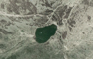
As well as exploring current glacial systems, you can also investigate areas of past glacial activity, this Tarn in the Lake District in Cumbria is a good example of glacial erosion by a cirque glacier.
Google Earth desktop also includes an option for weather, this example of the UK shows it with and without weather, it displays cloud, precipitation and temperature as well as various other things.
There is also the option of viewing buildings in 3D, this is not available for all locations, but New York City and Dublin are two places where 3D buildings are well created and accurate to real life.
There are many more things that Google Earth can do, for many locations you can view place tags, photos, borders, labels and roads, some places in street view, you can sroll down the street as if you are walking down it.
There are also many view options under the 'oceans' section which allow you to view shipwrecks, dead zones, protected areas, animal tracking and a marine census, all of this is included in the desktop version in addition to ocean exploration pictured above.
The great thing about Google Earth is that it allows you to save images of whatever you find and use them for research or in papers etc. Simply click file > save, and you're done!
There are also many extras that can be added to google earth if you run the latest version, information about the features of the latest version can be found here, this includes the moon, mars, the universe, historical imagery, earthquakes, 3D trees and webcams, plus a whole lot more!
The full list can be found here.
Overall, Google Earth is an excellent tool for a geographer, whether for general exploration, geomorphological investigation or mapping, definately a must have!


No comments:
Post a Comment